
GPS tracker & theft alerts · motorcycles first
Your bike, in sight.
OTEO is a compact tracker and a calm, visual app that watches your motorcycle while you’re away: where it is, whether it’s moving, and how much you can trust that information.
In development · Early access information coming soon
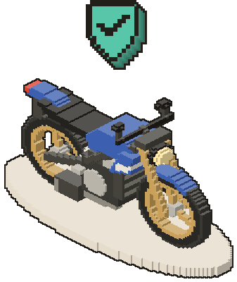
Design principle
Calm when calm. Obvious when urgent.
Security information only helps if you can understand it in seconds — sometimes at 3 a.m., sometimes under stress. OTEO is intentionally visual, friendly and clear, to reduce ambiguity instead of adding to it.
Visual
State is shown with word, shape and colour — not buried in numbers.
Understandable
One plain sentence first. Technical detail only when you ask.
Calm when calm
A parked, protected vehicle should never feel like an emergency.
Obvious when urgent
A real alert takes over the screen and says what to do next.
Pleasant
Something you don’t mind opening every day.
Quick under stress
Readable in under ten seconds, one action at a time.
01Product
What OTEO does
A small tracker on the vehicle, a cloud that never stops listening and an app that answers in seconds. Planned capabilities for the first version:
Know where it is — and how sure we are.

GPS / GNSS tracking
Satellite positioning from a tracker installed on the vehicle. Every position is labelled: precise fix, approximate or last known.

Real-time location
While the tracker is reporting, the map follows it live and shows the age of the data — “38 s ago”. When data goes stale, OTEO says so.

Location history
Trips, stops, events and alerts on one timeline linked to the map. Periods without data appear as gaps, never filled in with guesses.

Geofencing
Draw a circle or an area — Home, Garage, Work — and choose to be notified when the vehicle leaves it, enters it, or both.
Alerts that mean something.

Movement alerts
Arm protection with one tap. If the vehicle moves while protected, you are alerted straight away.
Push · email · Telegram
Theft detection
Movement while protected escalates to a critical alert: follow it live, then mark it as theft or false alarm. Tampering is flagged only when the device reports it.

Recovery mode
Once you confirm a theft, a persistent recovery mode keeps recording every position and stays visible across the app.
Know how fresh the data is.

Battery monitoring
Battery level or voltage, external power and low-battery alerts — shown exactly as the device reports them. No invented percentages.

Connectivity & device status
Last communication, position type, signal and power at a glance. An expected sleep is told apart from a delayed report, so silence doesn’t trigger false alarms.
02Tracker
A compact, autonomous GPS tracker.
Designed to hide inside the vehicle and keep reporting on its own, independently of your phone and the vehicle’s wiring. Planned hardware capabilities include:
 Motion & vibration detection
Autonomous, battery-powered
Runs on its own battery, independent of the vehicle’s electrics. Battery status is reported exactly as the device measures it.

Compact, hidden installation
Small enough to sit out of sight — under a seat, behind a panel or inside a fairing.
GNSS positioning
Satellite positioning outdoors, with the type and age of every fix always visible.

Wi‑Fi assisted positioning
Where satellites can’t be seen — garages, narrow streets — nearby networks can help estimate an approximate position, clearly marked as approximate.

Cellular connectivity
Reports over low-power cellular IoT networks such as LTE‑M and NB‑IoT, depending on final hardware and local coverage.
Motion & vibration detection
Designed with motion and vibration sensing to notice when the vehicle is moved, knocked or handled — including tamper-like handling.
Updates & event reporting
Regular location updates, plus immediate event reports when something happens.
Built for vehicle security
Designed around theft scenarios first: protection, alerts and recovery.
Concept illustration. Hardware configuration is being refined; final specifications will be published once confirmed.
03How it works
How it works
Three parts, one job: tell you what is happening to your vehicle, and how much you can trust that information.
- 01
Tracker
Installed on the vehicle. Takes its position from satellites, senses movement and sends compact reports over the cellular network.
- GNSS position
- Movement events
- Battery & power
- LTE‑M / NB‑IoT
- 02
OTEO Cloud
Receives every report, keeps the vehicle’s history, checks protection and geofence rules, and decides when — and how urgently — to notify you.
- History
- Protection rules
- Geofences
- Alert delivery
 03
03OTEO App
Shows status, map and timeline in seconds. Arm protection, receive alerts, follow live and resolve incidents. Designed for mobile and web.
- Now · History · Vehicle
- Push alerts
- Mobile & web
The tracker talks to OTEO Cloud, not to your phone: the history keeps building even when you’re not looking.
04Map
Context, not just coordinates.
A planned 3D view places your vehicle in its real street — buildings, trees, useful places and your geofences — so you understand at a glance where it is and what surrounds it.
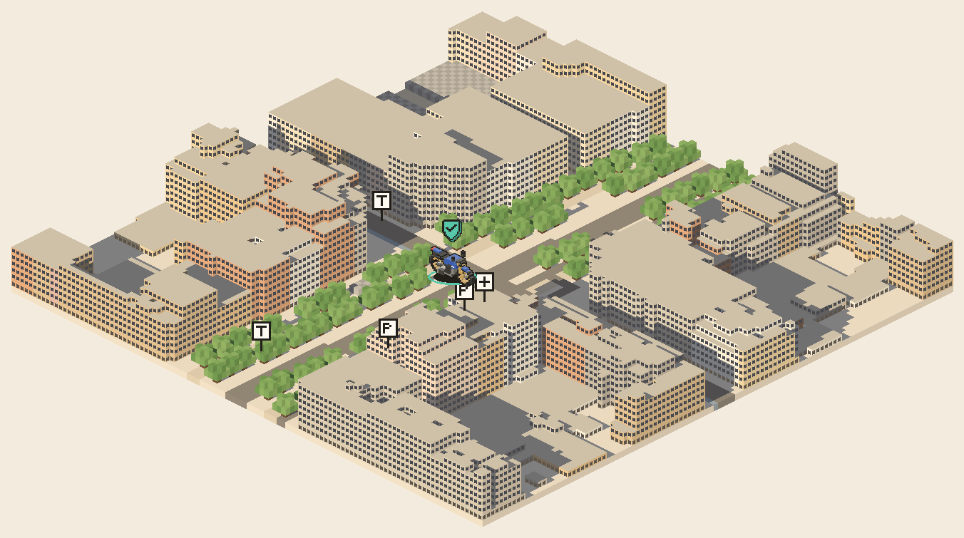
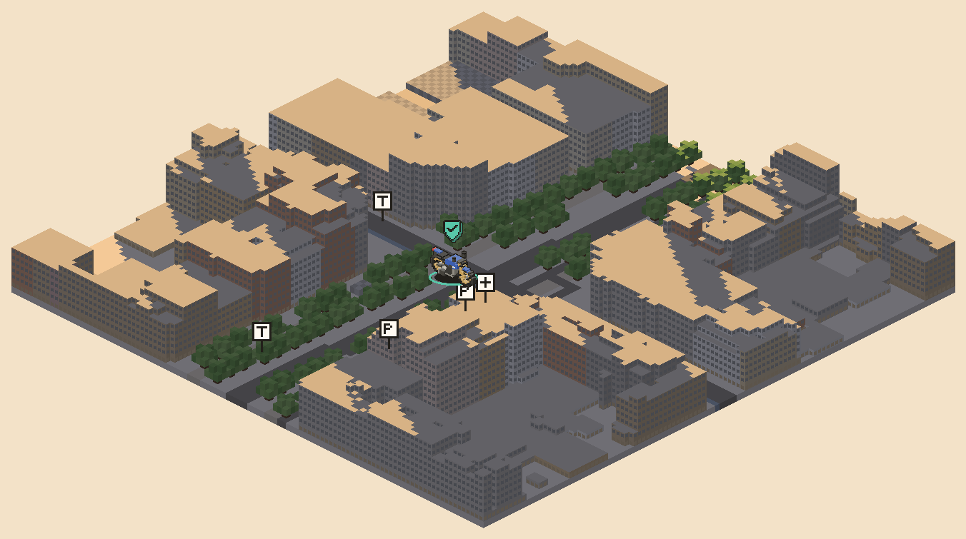
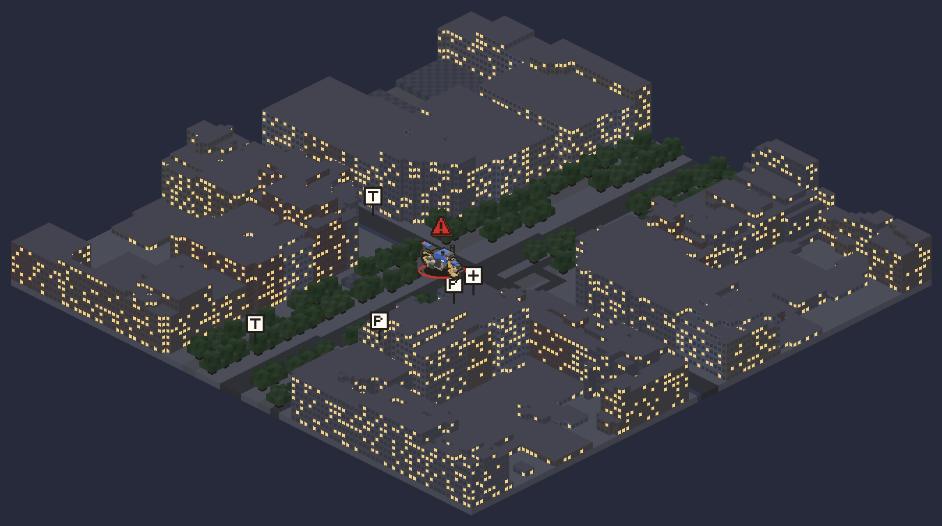 Protected · live
Real map data
Building footprints and heights from OpenStreetMap. Unknown heights are drawn flat, never guessed.
Light of the hour
The scene follows the sun at the vehicle’s location. At night, an alert is the only saturated colour.
Useful places first
Parking, fuel, workshops, police, pharmacies — everything else one tap away.
An optional layer
The fast 2D map stays the default. 3D is there when context matters.
05Security
Built for the moment something feels wrong.
OTEO is designed to help you detect anomalous situations around your vehicle — and understand them quickly. Normal states feel calm; serious events are impossible to miss.
One severity scale, from calm to critical
Colour warms up as urgency rises. Every level also has a number, a word and a symbol, so it never depends on colour alone.
- —Off
Unwatched
Protection is off. No colour, no alerts — just the map.
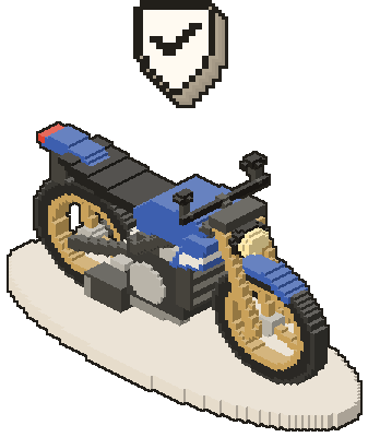
- 0Calm
Protected
Watching, with fresh data. Nothing is happening.
- 1Attention
Check when you can
No news, low battery or doubtful data. Silence is not theft.
- 2Warning
Something odd
A knock, possible tampering or silence after movement — without displacement.
- 3Critical
Moving while protected
OTEO takes over the screen and shows what to do next.
- RECRecovery
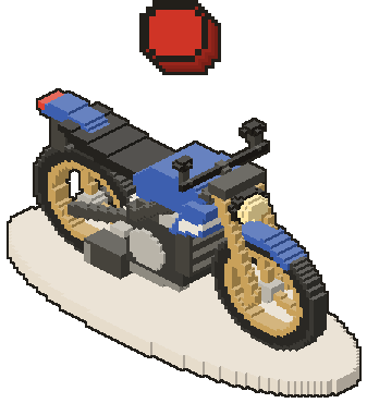
Theft confirmed
Every position is recorded; the mode stays on every screen.
Three independent signals, never mixed
- SecuritySet by you.
- Unprotected · Protected · Alert · Recovery
- MovementMeasured by the tracker.
- Moving · Stopped · Unknown
- CommunicationHow fresh the data is.
- Live · Expected sleep · Delayed · No data
Honest by design
- 1Never colour alone. Every level has a word, a shape and a colour, so it reads for everyone — including people with colour-vision deficiency.
- 2Last known is not current. Current, last known and approximate positions never look the same. A stale position always carries its time.
- 3Nothing invented. Missing data is shown as unknown. No interpolated routes, no guessed precision. Possible interference is a hypothesis shown with its evidence, never a verdict.
- 4Calm until it matters. Urgency is earned. Critical alerts get their own sound and bypass quiet hours; everything else waits its turn.
06AnalysisIn development
Intelligent incident analysis
Claude, by Anthropic, is planned as an intelligent analysis layer: it will help interpret anomalous signals from the tracker and the vehicle’s context, and explain what happened in plain language.
During an incident, the facts arrive as fragments: unexpected movement, GNSS signal loss, cellular connectivity changes, displacement from a geofence, battery and device events. Reading them under stress is hard.
The analysis layer will read that sequence and explain it — what happened, in what order, and what is still unknown. It is a support system for understanding incidents, not the core alert engine: tracking, detection and alerts keep working without it.
Tracker events
- Movement detected · protection on
- Left geofence “Garage”
- GNSS signal lost
- Cellular: serving cell changed
- Approximate position · ±300 m
- External power disconnected
Incident summary · draftIn development
Your MT-07 started moving at 03:11 with protection on and left Garage 16 seconds later. Satellite positioning was lost at 03:12; since then only approximate positions (±300 m) have arrived over the cellular network. At 03:14 the tracker reported that external power was disconnected. This sequence is consistent with the vehicle being moved, but it does not confirm a theft. Still unknown: its exact current position.
Where Claude fits
- Layer 1
Tracker signals
Position, movement, connectivity and power events from the device.
Core system - Layer 2
Alert engine
Rule-based detection and notifications. Works on its own, without AI.
Core system - Layer 3
Claude analysis
Will read the sequence and explain it in plain language, to support decisions.
In development
Situations it could help interpret
- The vehicle moved, but the owner’s phone doesn’t appear to be nearby (if the owner enables it)
- Location confidence drops unexpectedly
- Wi‑Fi and cellular positioning disagree
- Still connected over cellular, but GNSS quality changes
- Suspicious movement patterns
- Tamper-like behaviour
- Inconsistent signal patterns
- Low battery plus an unusual movement sequence
- Connectivity anomalies right after movement
How we are designing it
- 1Alerts don’t depend on it: detection and notifications remain rule-based.
- 2It only summarises events that were actually recorded. Unknowns stay unknown.
- 3It explains; you decide. Theft or false alarm is always your call.
The goal: turn technical signals into somethingvisualunderstandablecalm when calmobvious when urgenteasy to read under stress
07Community
Community-assisted recovery
A future, opt-in layer for theft scenarios. If the owner decides to, they can share selected information about a stolen vehicle so people nearby can help spot it.
- 1Opt-in. Nothing is shared unless the owner turns it on, incident by incident.
- 2Owner-controlled. The owner chooses exactly what to share, and can stop sharing at any time.
- 3Privacy-aware. Selected information only. No personal details by default; location can be shown as an area.
- 4Recovery-focused. One purpose: helping recover a stolen vehicle. Not a social network.
- 5Report, don’t intervene. Sightings go to the owner. The police remain the first call.
Stolen vehicle reportConcept previewBlue naked motorcycle, gold wheels
Reported stolen · last seen 03:14 · shared as an area
Shared by the owner
- Tracker status(shared)
- Last known location(shared)
- Photos of the vehicle(shared)
- Notes(shared)
- Owner’s personal details(not shared)
Community sightings
- 2 h agoBlue bike with gold wheels loaded into a white van near the market.
- 45 min agoSimilar bike parked behind the petrol station, no plate visible.
08Vehicles
Motorcycles first. More vehicles next.
OTEO is initially focused on motorcycles. Broader vehicle support is planned — with the same tracker approach, the same calm interface and the same severity scale.
- Initial focus
Motorcycle
Naked, scooter, sport and adventure bikes: the first version is designed around them.
 Planned
Car
Protection, alerts and history for cars.
 Planned
Van
Vans and light commercial vehicles.
 Future
Truck
Larger vehicles, further ahead.
Concept preview. Car, van and truck renders illustrate planned support; they are not available yet.
09App
Three questions, three places.
The app is designed to answer in seconds — is it OK, where is it, what should I do? Everything technical stays two taps away.
NowIs it OK? Where is it? What do I do?
Status in one sentence, the map, one contextual action and just enough context to trust the data.
HistoryWhat happened?
Trips, stops, events, alerts and data gaps on a single timeline, always linked to the map.
VehicleHow is it set up?
Protection, geofences, notifications and the installed tracker. Technical telemetry lives here.
Concept screens from OTEO’s current app design. The app is in development and details will change.
 MT-07
MT-07
 38 sGPS3.92 VWatchingNowHistoryBike
10Status
OTEO is currently in development.
We are building the first version: tracker, cloud and app. Early access information coming soon.
Ask to be kept posted- In development
App & cloud
Status, map, history, protection and alerts — the core of the first version.
- Being defined
Tracker hardware
Refining the GNSS, Wi‑Fi and cellular IoT hardware configuration.
- In development
Incident analysis with Claude
Plain-language incident summaries on top of the alert system.
- Concept preview
3D map view
An optional spatial layer over the default 2D map.
- Planned
Community-assisted recovery
Opt-in, owner-controlled sharing for theft scenarios.
- Planned
More vehicle types
Cars, vans and larger vehicles after motorcycles.
- Coming soon
Early access
Details on how to take part will be published on this site.
11Get in touch
walid@oteogps.com
Questions, partnerships or feedback on the product — write to us directly.